First Time Visitors Guide For NYC Subway


How to Ride the New York City Subway: First-Time Visitor’s Guide
New York City’s public transit system is one of the most famous—and busiest—in the world. But if it’s your first time visiting NYC, the subway can feel like an endless maze that might just lead you to the Upside Down. That’s why many visitors try to avoid it altogether. But in a city this big (and expensive), the subway is your best way to save time and money while exploring. Knowing how to navigate it can make or break your trip.
{{ad-three}}

Why the NYC Subway Is the Best Way to Explore
The subway runs 24 hours a day and connects all five boroughs—Manhattan, Brooklyn, Queens, the Bronx, and Staten Island.
The current fare is $2.90 per ride, but it’s expected to increase to $3 or more in 2026.
MetroCards are being phased out for the new OMNY tap-and-pay system, and the MTA has rolled out a new, brighter subway map to make it easier for first-time riders.
This guide breaks down the new payment system, accessibility tips, subway etiquette, and smart navigation tricks—everything you need for a smooth first ride.
Say Goodbye to MetroCards: The New OMNY System
MetroCards will be phased out by December 31, 2025.
After that, you’ll need to use a contactless debit or credit card or an OMNY card to tap and pay at subway turnstiles.
How Tap & Pay Works
If you already have a digital card on your phone or smartwatch, simply tap your device on the OMNY reader, wait for the green light, and go.
Avoiding International Transaction Fees
If you’re visiting from outside the U.S., each tap might trigger a bank transaction fee.
To avoid that, buy an OMNY card (costs $1) at any subway station. Load it with cash and tap just like you would a MetroCard.
💡 Tip: It’s easy to add more funds to your OMNY card, but getting a refund isn’t simple. If you’re a visitor, don’t overfill it—unused balances stay tied to your OMNY account.
Group Travel and Kids Ride Free
* Children under 44 inches (112 cm) ride free.
* One OMNY card can pay for up to four riders.
* Sometimes banks flag the first tap as potential fraud, delaying group payments. To avoid issues, take one short ride when you first arrive in NYC to verify your card—after that, multiple taps will work smoothly.
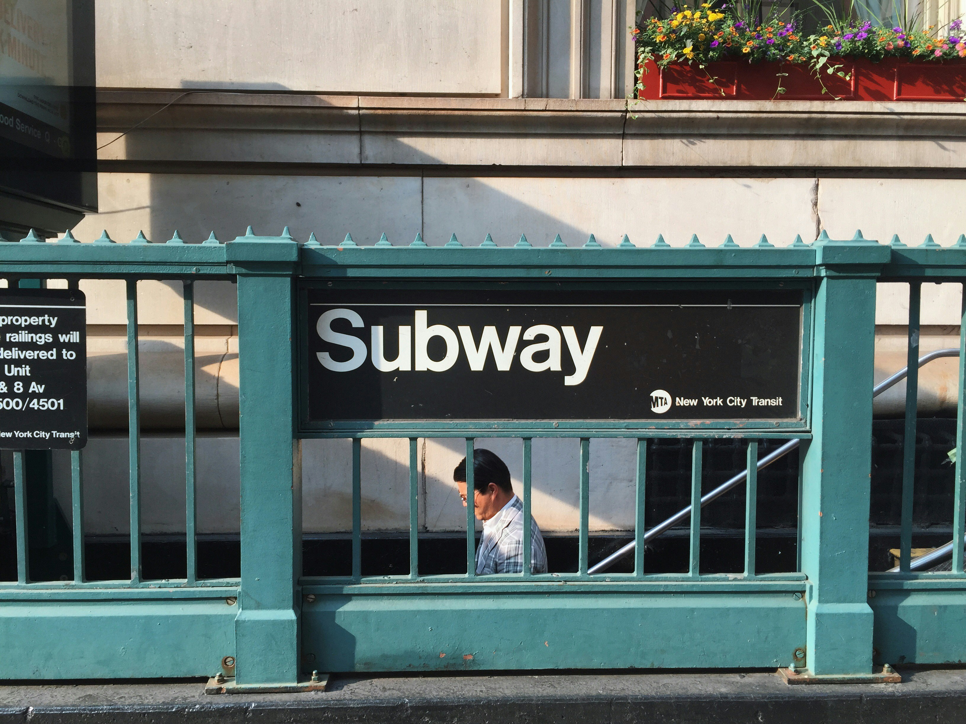
Finding the Right Subway Entrance
In Manhattan, most subway lines run underground.
Look for the familiar green and white “Subway” signs near building corners or stairways.
You’ll often see globes at the top of stairways:
* 🟢 Green globes = entrance open
* 🔴 Red globes = exit only
Accessibility Tip
If you use a wheelchair or mobility scooter, look for the blue accessibility icon on maps or signs.
Not all accessible stations have working elevators, so use larger stations (like Times Square–42nd Street or Grand Central) whenever possible.
🔗 You can check the official wheelchair-accessible subway map on the MTA website for real-time elevator status. https://www.mta.info/map/5346
{{ad-one}}
🧭 Uptown or Downtown? Understanding Subway Directions
This is where most visitors get confused—there are no signs that say “This way to Central Park.”
Here’s how to think about it:
* Uptown = north toward the Bronx
* Downtown = south toward Brooklyn
When entering a station:
* Small, local stations have “Uptown” or “Downtown” signs before you go through the turnstile.
* Larger, express stations (like Times Square or 14th Street) may only show direction signs after you’ve entered.
If you end up on the wrong platform, check for cross-passages—some stations let you switch sides for free.
But at smaller local stops, you may need to exit and re-enter, paying the fare again.
💡 To avoid double-paying, ride to the next express stop and transfer there instead.
Understanding the New NYC Subway Map
The MTA released a new, visitor-friendly map that clearly shows which lines are local or express.
Here’s what to know:
* Train lines are identified by letters or numbers (not colors).
* The color represents the line, not the specific train. (For example: the red line includes both the 1, 2, and 3 trains.)
* Local trains make all stops.
* Express trains skip several stops for faster travel.
🚫 Don’t refer to trains by color. That’s one of the fastest ways to get lost—or end up somewhere you didn’t plan!
How to Plan Your Day Around the Subway
Think of the subway as your link between neighborhoods, not your full-day itinerary.
Don’t plan your trip the way you would with a car. Instead, group your activities by area.
For example:
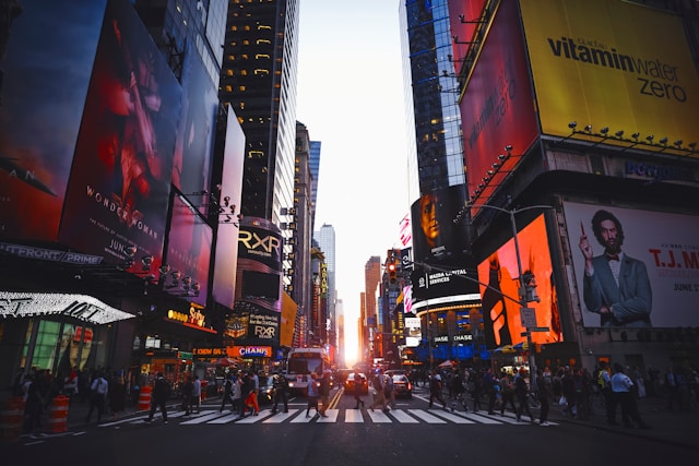
* Spend a morning in Midtown Manhattan (Times Square, Rockefeller Center, Bryant Park).
* Then hop on the subway to Lower Manhattan (9/11 Memorial, Statue of Liberty, Brooklyn Bridge).
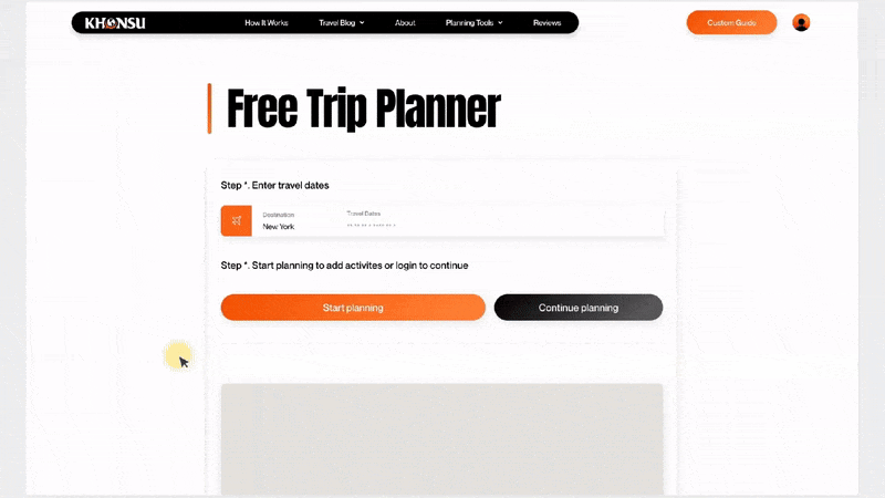
Free Trip Planner
Our interactive trip planner drops a pin for every attraction you add—so you can see exactly where everything is located.
It helps first-time visitors build smart routes and avoid long, confusing transfers.
We also create custom travel guides for special occasions—perfect for honeymoons, birthdays, or anniversary trips.
{{ad-two}}
Essential Subway Safety & Etiquette Tips
Riding the subway is generally safe, but here are a few must-know rules:
1. Always stand behind the yellow line for safety.
2. Let riders exit before you board.
3. Avoid empty train cars—they’re usually empty for a reason (broken A/C, bad smell, or safety concerns).
4. Skip rush hour if possible:
* Morning: 7:30–9:30 AM
* Evening: 4:00–6:30 PM
NYC has the largest school district in the U.S., so trains fill up early!
Best Apps for Navigating NYC Transit
If you’re new to public transit, Google Maps is your best friend.
It provides real-time subway routes, walking directions, and transfer updates.
🎥 Want to see it in action? Check out our video on how to use Google Maps with the NYC subway for step-by-step guidance.
Watch the full video on YouTube
{{ad-three}}

Local Tips
Delivered Weekly
Travel Planning Is Easy With Our FREE Trip Planner

Memories are made here

Travel Tools
E-Z Guide

Smart Guide
Customized Travel Guide